Death Valley’s Ubehebe Crater – A Visitor’s Guide
Introducing Death Valley’s Ubehebe Crater
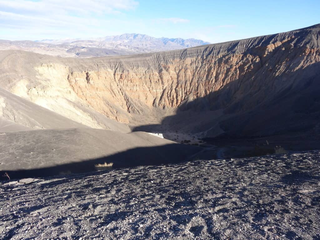
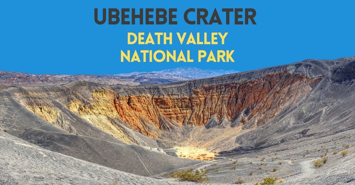
There’s a massive crater in Death Valley National Park. It’s the Ubehebe Crater (pronounced: “YOU-bee-HEE-bee.” And while many suspect it is a gigantic indentation in the earth caused by an ancient meteor strike, it was formed by volcanic activity.
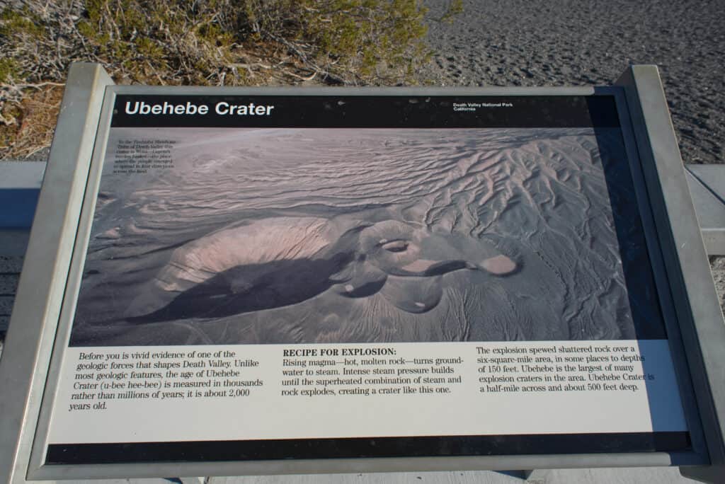
Visiting the crater is an impressive experience. The crater is about one-half mile wide and is nearly 750 deep. Scientists believe this crater is over 2,000 years old.
The Places Where We Go contains affiliate links and is a member of the Amazon Services LLC Associates Program. As an Amazon Associate, we earn from qualifying purchases at no extra cost to you when you purchase using one of these Amazon links. Read our disclaimer and privacy policy for more information.

Where is Ubehebe Crater located?
You’ll need to travel a bit from the main destinations of Death Valley National Park to reach Ubehebe Crater. It sits in the park’s northern end on the way to Scotty’s Castle.
The crater’s location is where you’ll start your journeys to some well-known but remote spots in Death Valley, including the Lost Burro Mine, Racetrack Playa, and Teakettle Junction.
Getting to Ubehebe Crater

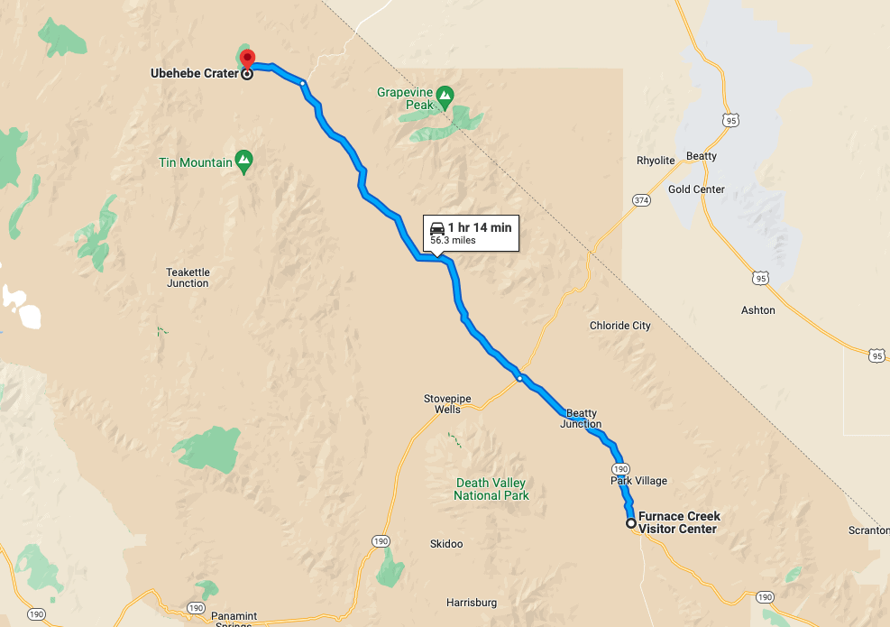
From the Furnace Creek Visitor Center, you’ll drive northwest 56.3 miles traversing CA-190W and Scotty’s Castle Road. Make a right when you get to Scotty’s Castle Road.
Once you reach Ubehebe Crater Road, stay left, and drive 5.3 miles to the parking area.
Just to let you know, there are no restrooms at the Ubehebe Crater trailhead. If you need a restroom, stop at the Grapevine Ranger Station when you turn onto Ubehebe Crater Road.
Hiking Paths at Ubehebe Crater
When you hike the area at Ubehebe Crater, you can see many smaller craters besides the mammoth Ubehebe Crater. Being here is an impactful experience and is helpful to appreciate the power of the volcanic events that created this landscape.
You have several hiking path options at Ubehebe Crater. Each trail provides a unique way to experience and appreciate Ubehebe Crater.
Ubehebe Crater Rim Trail
The Ubehebe Rim Trail is a fantastic way to experience the grandeur of Ubehebe Crater. This nearly 3-mile hike should be done counterclockwise to make the elevation gain more accessible, and you will reach the highest point along the rim quicker.
Here you can view the extensive debris left behind from the crater’s violent beginnings. Remember to watch children and avoid going too close to the edge, as the volcanic cinder is unstable and slippery underfoot. Furthermore, try to stay on visible trails in order not to disturb any of the sensitive plant or animal life living here.
This trail that circumnavigates the crater is a great way to escape the crowds and take in this remarkable landscape.
Descend into Ubehebe Crater
Descending to the floor of Ubehebe Crater is an unforgettable way to experience this natural wonder. The trail leading down starts right at the viewpoint and drops more than 500 feet within 0.25 miles, making it fun and easy thanks to the loose, deep cinder that cushions each step.
Once you reach the bottom, take some time to explore the dry, cracked mud and vegetation. When it’s time to go back up, you have two options; the left trail is shorter but steeper and looser, whereas the right path is slightly longer with a cinder that isn’t as deep. Opt for the latter – it will be much easier unless you’re up for a challenge.
Little Hebe Crater
Visit Ubehebe’s smaller cousin, Little Ubehebe Crater – Take a mile out-and-back walk at Ubehebe Crater’s western edge to reach this second crater. It’s one of the area’s youngest of nearly dozen craters.
To get to Little Hebe Crater, begin your journey on the trail. At the Ubehebe Crater viewpoint, you’ll follow the rim trail towards the right as the signage indicates to reach Little Hebe. After 0.25 miles, you will get to a split in the path; the right fork is slightly more adventurous and winds along the of an unnamed crater, boasting views of the gray volcanic badlands. Shortly after, at 0.3 miles, the left and right forks will rejoin at the rim of Little Hebe Crater. Here, you can marvel at its sharp lines of volcanic cinder – a reminder of how young this crater is. Enjoy completing a loop hike around Little Hebe and either return the way you came or keep going along the rim of Ubehebe Crater.

Ken Lund from Reno, Nevada, USA, CC BY-SA 2.0 https://creativecommons.org/licenses/by-sa/2.0, via Wikimedia Commons
Is there more than one crater in Death Valley?
Yes, besides the famous Death Valley crater Ubehebe, you can also visit Little Ubehebe Crater, another photogenic earthly formation in Death Valley.
But of all the earthly indentations in Death Valley, the biggest by far is the Ubehebe Crater.
Do you need to hike to visit Ubehebe Crater?
What if you don’t like hiking? Can you still see Ubehebe Crater? Absolutely. While doing a bit of walking will let you explore more of this geological feature, you can drive your car into the adjacent parking lot, get out and get a glimpse of the magnificent crater before you drive off to the next attraction in Death Valley.
What else can I do near Ubehebe Crater?
If you’re interested in hiking, consider one of these nearby hikes to supplement your journey to Ubehebe Crater.
Fall Canyon Hike
Stroll through Fall Canyon in Death Valley National Park for an unforgettable experience. Easily accessible and with a gentle grade, the canyon walls reach an impressive 2000 feet high. Along the hike, you’ll witness the vivid hues of reds, whites, blacks, and greys that make up its geologic strata. As you progress, take in the spectacular side canyons and prepare to tackle a 20-foot dry fall.
For those feeling particularly brave, there’s an opportunity to scramble up the south slope of the falls and explore the stunning narrows of lower Titus Canyon beyond. However you choose to experience it, Fall Canyon will surely be an unforgettable hike!
Titus Canyon Road
Titus Canyon in Death Valley National Park is a breathtaking and remarkable sight. Embark on an adventurous journey along the 27-mile Titus Canyon Road, winding through narrow paths and thrilling curves requiring a high-clearance vehicle. Enjoy sweeping views of Red Pass Hill before hiking to Thimble Peak or descending into Leadfield ghost town, complete with Klare Spring and ancient Native American Petroglyphs.
For hikers, the stunning narrows of Titus Canyon stretch for 1.5 miles, in places only 20 feet wide and hundreds of feet deep. Don’t miss out on nearby Fall Canyon if you want to extend your hiking experience.
Thimble Peak
If you’re exploring the incredible Titus Canyon Road, why not hike up Thimble Peak? It’s only 5 miles round trip with a bit over 1300ft in total elevation gain, making it an ideal option for those looking to get great views without too much effort.
The trail starts at Red Pass and takes you up the ridgeline to the base of Thimble’s steep limestone cliffs. The switchbacks up the northern ridge may look daunting, but they’re relatively tame with careful navigation. From the summit, you’ll be rewarded with incredible, sweeping views as good as those from Telescope Peak! However, be cautious during the last approach; it involves some steep and potentially exposed scrambles. Enjoy the view!
Visit Scotty’s Castle
A visit to Scotty’s Castle is a must-see attraction in our book. However, flooding over recent years caused substantial damage to the historic place. This resulted in a multi-year closure. Scotty’s Castle is closed at the time we are writing this post. However, it is estimated to reopen in a couple of years.
Check with the National Park Service for the conditions and ability to visit Scotty’s Castle at the time of your visit.
What to pack for your visit to Ubehebe Crater?
The essentials are water – plenty of water. And because it is a distance to reach Ubehebe Crater, you’ll likely want to pack food.
You’ll also want to have plenty of sunscreen with you as the sun can get intense in Death Valley.
Wide-brimmed hat
Sunglasses
Get Our Free Comprehensive Death Valley Packing Checklist
How was Ubehebe Crater created?
Ubehebe Crater was formed by a process known as Maar volcanoes. This happens when hot magma from deep underground meets groundwater, causing an explosive reaction of steam and gas. The explosions created the Western cluster of maar volcanoes first, followed by the Southern cluster, and finally, Ubehebe—the largest of them all—which is believed to have formed approximately 2,100 years ago.

Frequently Asked Questions – FAQ
This is the most important question if you want to visit Ubehebe Crater. Check the Death Valley National Park website for current conditions during your visit.
Visiting Ubehebe Crater is a fantastic year-round experience, but for the most enjoyable trip, it’s best to plan your visit from mid-fall to mid-spring. Summer temperatures here can be very high, and no shade is available, so if you’re looking for a comfortable hike, aim for the cooler months.
Plan to visit in the morning before the sun begins to heat Death Valley or closer to sunset. Either time should be cooler than midday. Plus, the sun’s shadows create a fantastic effect on this landscape.
You are required to pay an entrance fee to enter Death Valley National Park. Once your national park fee is paid, there is no extra cost to visit Ubehebe Crater.
No. We visited Ubehebe Crater in a small Honda Hybrid. While a 4×4 can be handy in many parts of Death Valley, such a vehicle is not essential to visit Ubehebe Crater.
Permits are not required for day hiking in Death Valley National Park.
Gas in Death Valley National Park is minimal and expensive. Read our post about gas stations in Death Valley before your trip.
A meteor strike did not create Ubehebe Crater. Rather, it was created by volcanic activity.
No. The largest U.S. crater is Meteor Crater west of Winslow, Arizona. It is 4,000 feet in diameter and nearly 600 feet deep. A giant meteorite created it.
Read our guide on the Best Times to Visit Death Valley National Park
Where Can I Stay Near Ubehebe Crater?
Check out our guide on the best places to stay during a visit to Death Valley. We’ve curated a list of locations within and outside the park.
Our list includes budget options through luxury options and various accommodations from hotels to B&Bs, RV parks, and tent sites. You have great options within Death Valley, from Panamint Springs Resort to Stovepipe Wells. Campers have plenty of campsites to select from at Furnace Creek Campground.
Check out our full list:
Where To Stay In Death Valley – Your Guide to 18+ Top Places
Death Valley National Park – Know Before You Go
✈️ Closest Airport: Las Vegas McCarren (LAS)
⏰ Time Zone: Pacific Standard Time (GMT-8)
Check Out These Additional Posts About Death Valley
One Day Death Valley Itinerary – 9 Awesome Stops
6 Awesome Death Valley Sand Dunes
Subscribe to our Newsletter
#ubehebe #ubehebecrater #deathvalleycrater


3 Comments
Comments are closed.